Adwick Maps
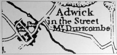
Mr. Duncombe had purchased the manor of Adwick le Street from Anthony Eyre in 1762.
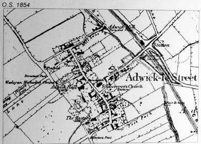
The main alterations to Adwick le Street between 1772 and on the second map of 1854 are:
1. The closing of the road continuing from Red House Lane across the SW of the Hall and Rectory and the removal of two buildings in order to enlarge and landscape the garden belonging to the hall.
2. The coming of the railways and building a Railway Station to the NW.
Also on the 1854 map, note the moated site of an early manor house along Church Lane, South West of the Mill Stream.